Guerilla Trek Nepal trek in pokhara
Guerilla Trek Nepal trek in pokhara
Guerilla Trek Nepal trek in pokhara
Guerilla Trek Nepal trek in pokhara
Guerilla Trek Nepal
Guerilla Trek Nepal
Guerilla Trek Nepal

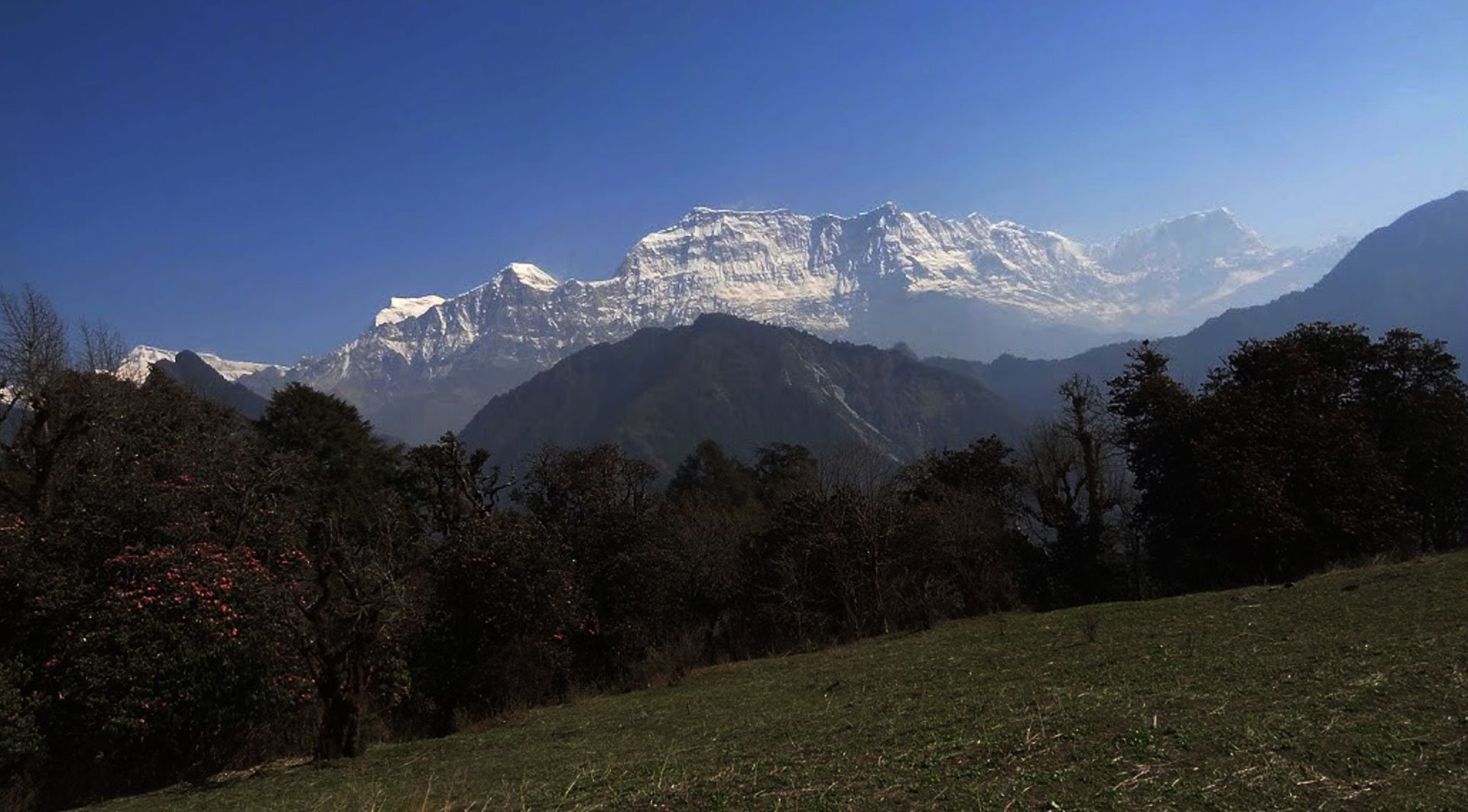
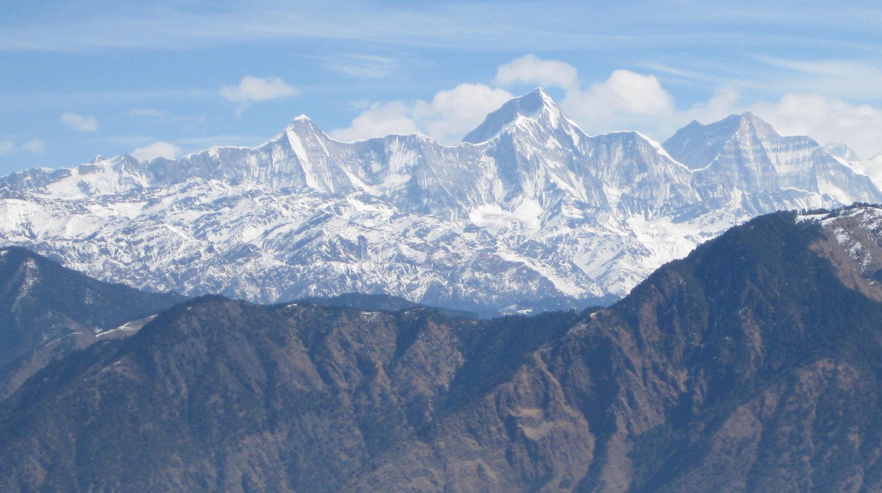
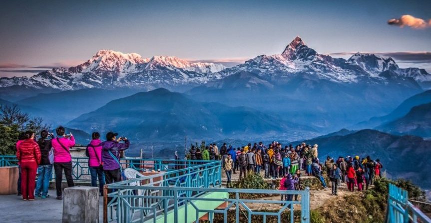
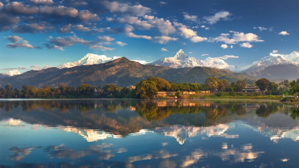
A new trekking route from Myagdi to Rukum follows trails used by the Maoists during the war.Now, trekkers can retrace the footsteps of the guerillas and imagine what it must have been like to hike and fight in this kind of terrain. The trail starts in Beni, skirts Baglung, passes the Dhorpatan Hunting Reserve and goes on to Rukum and Rolpa, takes up to 13 days. All along, there are spectacular views of the Dhaulagiri range from high ridges and large meadows fringed by pine forests. The trail has a historic attraction, but there are also challenges of infrastructure and making locals aware of how they can benefit from tourism.
Guerilla Trek Nepal
Guerilla Trek Nepal
Tribhuvan International airport (Google Map)
3 Hours Before Flight Time
From the Myagdi district headquarter you follow a gravel road for 24km to Darbang and start walking. Takam is a three hour walk away with Gurjal Himal towering overhead.
This is where the scenery starts getting even more dramatic. This is what Nepal used to be like before the trekkers got here. Locals are not used to foreigners and have a lot of stories to tell about the war.
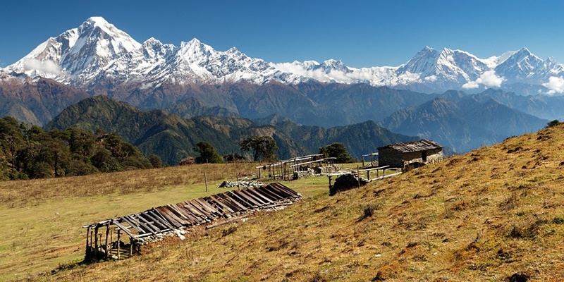
Climb through dense pine forests, with musk deer darting in the undergrowth. The meadows on the ridge offer 180 degree views of Dhaulagiri the entire range up to Churen Himal in the west.
You cross over from Myagdi to Baglung and into the former Tibetan refugee camp which was serviced by an airfield built by the Swiss in the 1950s. This is also the entrance to Dhorpatan, a Hunting Reserve, where you can spot mountain goats and blue sheeps(Bharal)
This is a paradise for birds. Watch danphes pheasants, and other migratory species that you have seen only in bird guides. Hard to imagine that people fought a war here. There are cow sheds in the monsoon, but in the winter these high pastures are deserted.
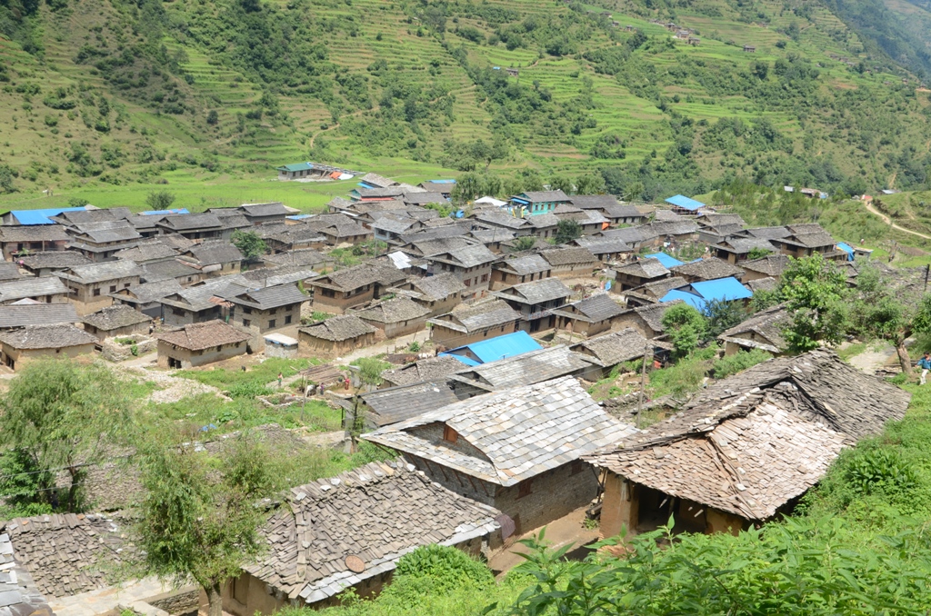
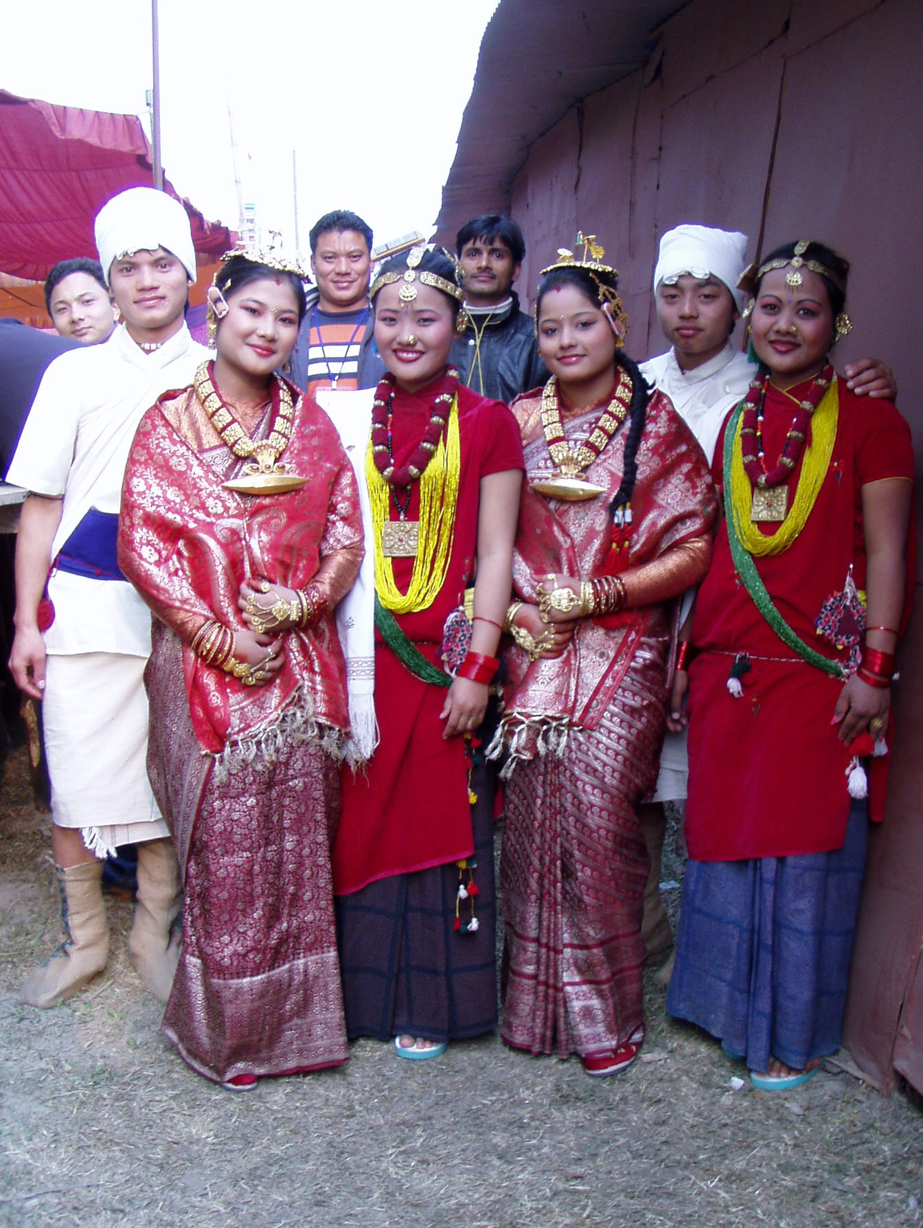
Cross over from Baglung to Rukum into Magar country and enter the fromer Maoist base area. There are dense forests all the way, so it must have been easy to hide here from the helicopter patrols. The villages are picturesque and there is always some kind of Magar festival going on.
Walk to Lukum in Rukum, a village populated only by Magars and Dalits(low cast). This is about as medieval as it gets in Nepal nowadays.
Thabang is the cradle of the Maoist revolution. It was damaged in army attacks and parts of the town were flattened by ‘tora bora’ mortar shells
dropped from helicopters. There has been some development of infrastructure after the war ended, and the people are eager and friendly.
The highest point in Jaljale is Dharampani (3900m) and there is a great view from Apisaipal in the west to Dhaulagiri in the east.
Now we’re moving down from the high mountains and the village are ethnically mixed.
This is where we finally get to Rolpa and the roadhead. Rolpa was also a rebel base area and for many of the ten years of war under total Maoist
control. You can eat at one of the many commune restaurants run by Maoist cooperative, where staff are relatives of those who were killed in the fightings.
