flora and faunas
Annapurna Conservation
Annapurna Hot Spring Trek
Annapurna Hot Spring Trek
Annapurna Hot Spring Trek
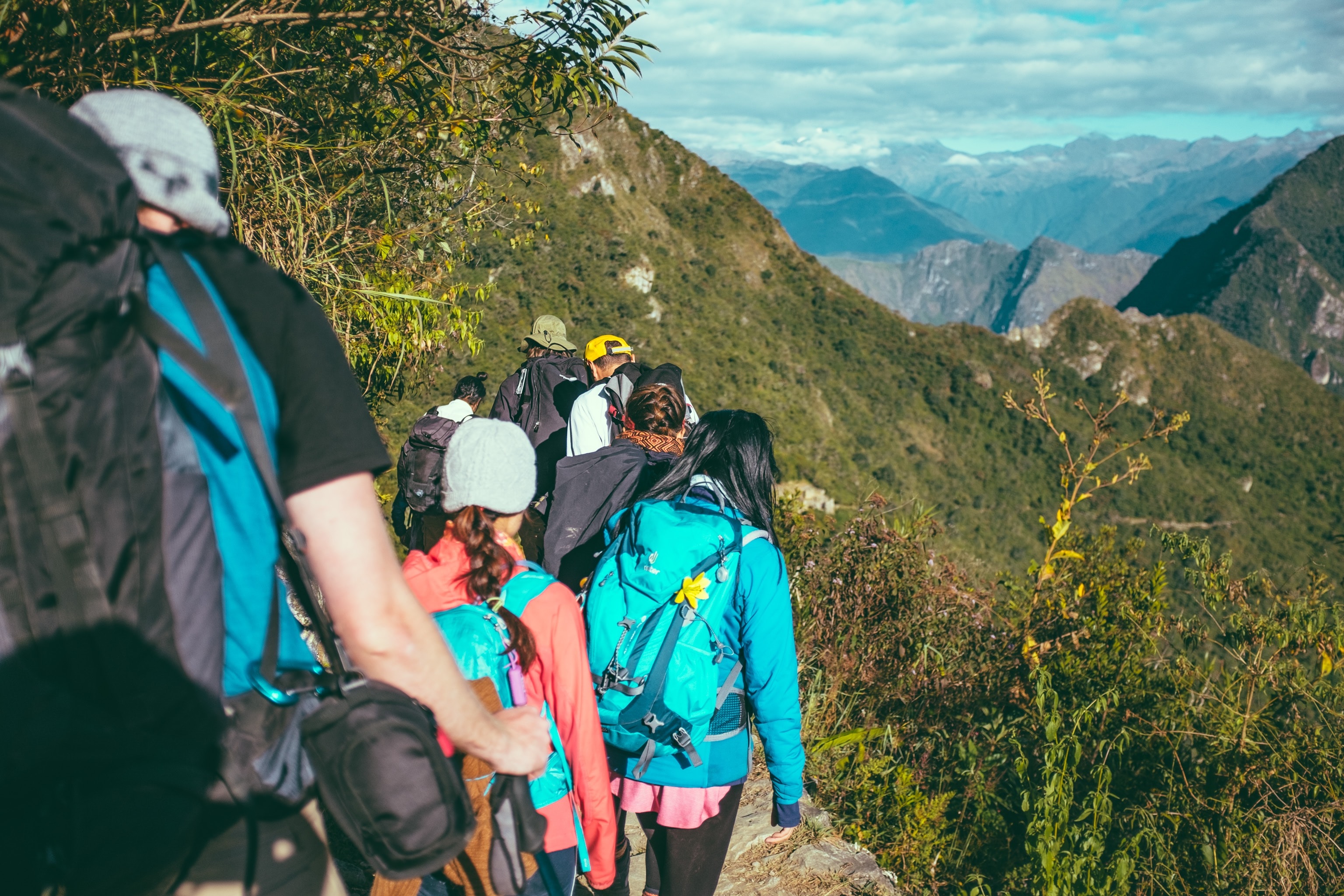
Trekking in Nepal
Trekking in Nepal
Trekking in Nepal

Annapurna Tatopani trek offers the stunning views of Himalayas, different cultural people, pilgrimage sites, field terraces, gorges and with different types of flora and faunas. This region offers moderate to rigorous treks depending upon the adventurous desire of the trekkers. Here anyone can make trekking as per their time frame.
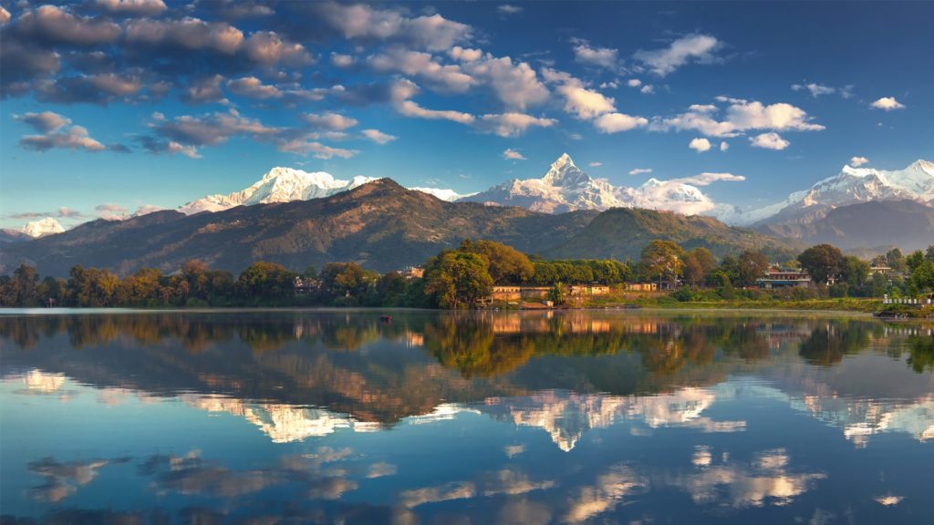
This trekking in Annapurna Conservation encompasses forested middle mountains, high Himalayas and trans – Himalayan desert plateau ecosystems. The area is dominated by Annapurna Ist 8091 m the 10th highest in the world, Schima and chestnut trees are found in the subtropical forest between 1000-2000 m which give way to rhododendron, oak, hemlock and silver fir as you ascend to the temperate zone (1700 – 3000 m). Rhesus monkeys, yellow-throated martens & Himalayan weasels are some of the wildlife commonly encountered. Among the birds found in this region are the Himalayan griffons, Lammergeier, forktail, redstart, thrush and kingfisher to name a few. Gurung, Magar, Thakali & Brahmin villages dot the lower elevations.
Outline Itinerary:
Day 01 – Arrival in Kathmandu
Day 02 – Kathmandu to Pokhara
Day 03 -Pokhara to Tolka-
Day 04 – Tolka to Ghandruk-
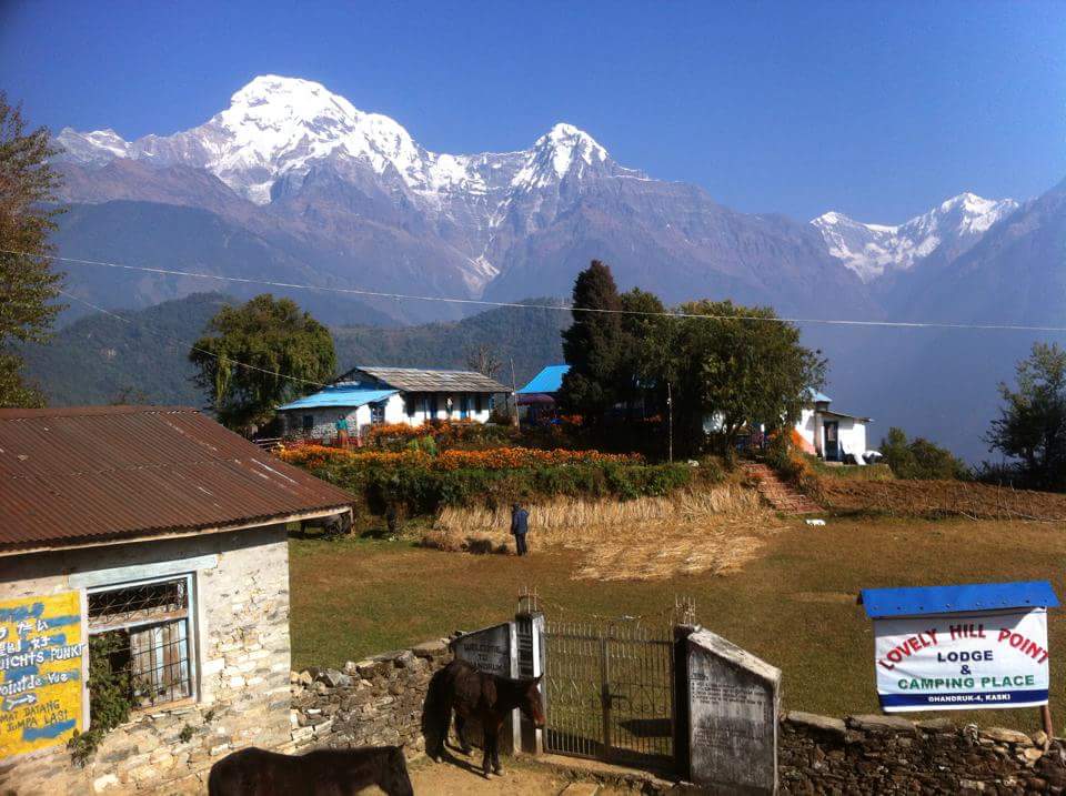
Day 05 – Ghandruk to Tadapani (2630m)-
Day 06 – Tadapani to Ghorapani/Deurali (2870m)-
Day 07 – Ghorapani to Tatopani (1220m)-
Day 08 – Tatopani to Beni and Pokhara (820m)-
Day 09 – Pokhara to Kathmandu
Tribhuvan International airport (Google Map)
3 Hours Before Flight Time
Upon arrival at Kathmandu International Airport transfer to your hotel. Short briefing will follow concerning the necessary formalities. Depending upon your arrival time you may spend free time visiting nearby sanctuaries or resting.
Fly or drive to Pokhara, from where you will depart on your trek. Overnight in Pokhara.boating and sightseeing in beautiful Lake Side area.
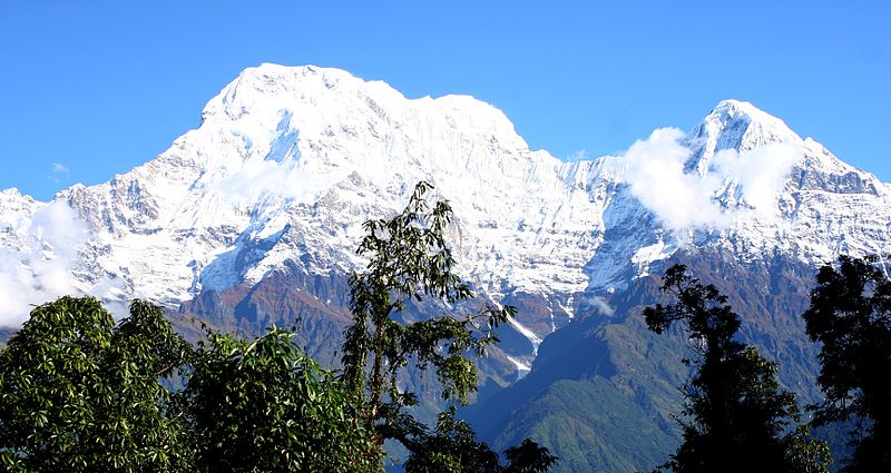
After a 30.minuts short drive to Phedi and starting at an elevation of 1130 meter, in a forest that is so overgrazed that it looks like a manicured municipal park we start climbing to Dhampus on the top of a ridge at 1700 meter. The route then enters a rhododendron forest and follows a trail paved with stones to the village of Pothana. From here, we have excellent views of Machhapuchare mountain (6997m). Machha, meaning fish and puchhare meaning tail, except from this angle it looks more like the Matterhorn then resembling a fishtail. The trail climbs further on a stone paved route to Deorali atop a hill at 2150 meter. We descend then into the canyon of Modi Khola down a rough stone trail to the teahouses at Bheri Kharka, a suburb of the large Gurung village of Bichok, which is far below. After climbing out of the valley following flagstone steps we arrive in the small settlement of Tolka at 1790 meter (5-6 hrs).
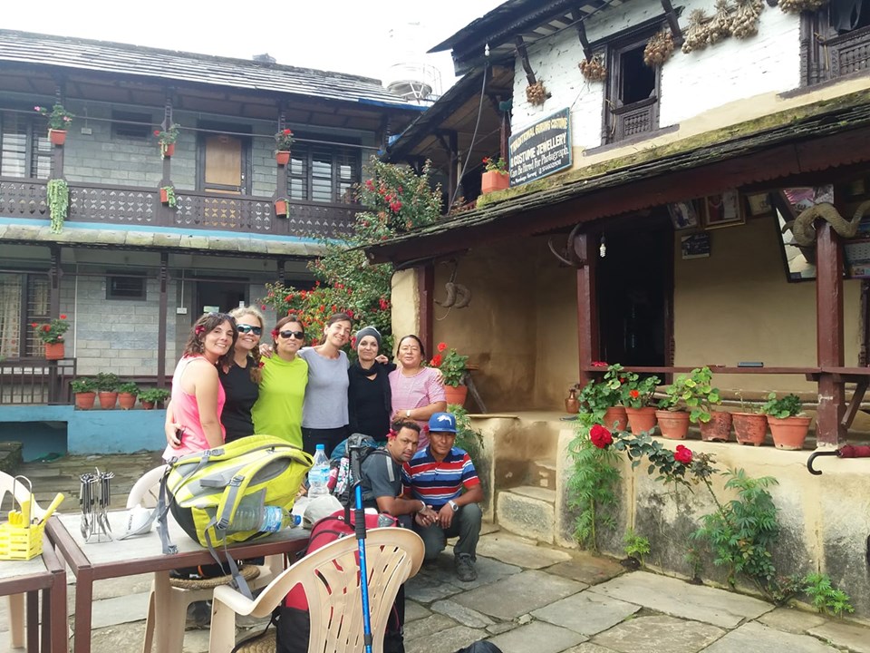
The trail descends a long staircase to a suspension bridge across the Tiku Khola at 1720 meter and then climbs up to a ridge. It is an easy walk past streams, fields and unusual oval-shaped houses to the Gurung village of Landruk. Past this village, our downhill trail leads to the river Modi Khola and then ascends steeply to the Gurung village Ghandruk at 1990 meter. Ghandruk is the second largest Gurung village of Nepal, and is a confusingcluster of closely spaced, slate-roofed houses. The views of Annapurna South from here are amazing, and Machhapuchhare can be seen in its fishtail form (5-6 hrs).
Today we ascend around 700 meter to the village of Tadapani, meaning ‘far water’, because of the long distance the nearest water supply was from the village. The trail leads us at first over stone paved steps and then we ascent among bigger rocks crossing a few streams on the way (3-4 hrs)
We start the day by descending to the Bhurungdi Khola river, followed by a steep rocky ascent to the village of Ban Thanti at 3180 meter. Afterwards we follow a stream, which offers good swimming opportunities in some of its pools. We descend through pine and rhododendron forests to the village of Ghorapani at 2750 meter and then we continue with a short walk to
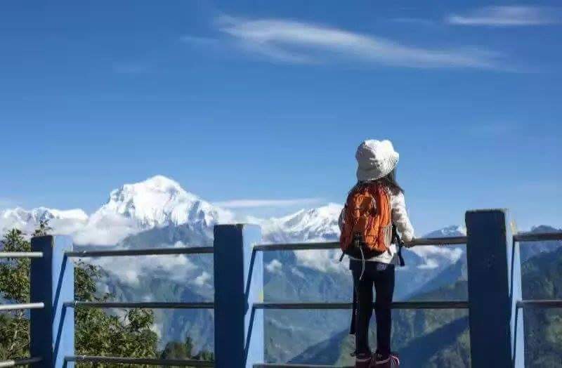
Deurali (meaning pass) at 2870 meter. From here we have a great panorama of Dhaulagiri I (8167m), Tukuche, Annapurna South, Annapurna I (8091m), Hiunchuli (6441m) and Tarke Kang (7193m) (5 hrs).
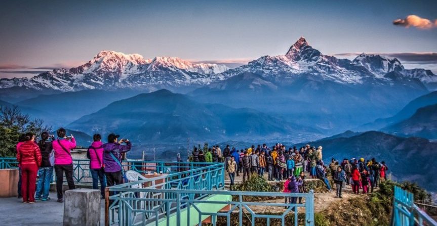
Everyone rises early today to make the early morning excursion to Poon Hill (3210m) about an hour’s climb from the pass. At sunrise, there is a
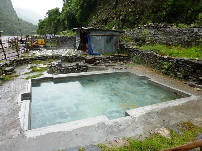
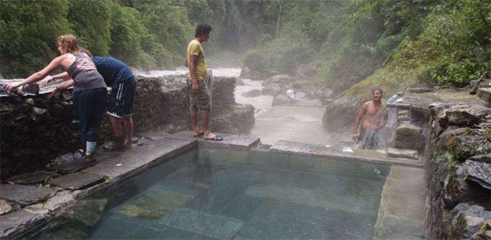
spectacular unobstructed view of the high Himalaya. After returning to Deurali for breakfast we make a steep descend through rhododendron and magnolia forests, we pass some small villages and walk alongside the Ghaja Khola. In Tatopani (which means hot water in Nepali) there are natural hot water springs for your refreshment, be sure to bring a bathing costume. We stay overnight in Tatopani (5-6 hrs).
We cross the high suspension bridge over the Kali after which we ascend to the Bhraman village of Rato Pani. After leaving this village we descend along a vertigo inducing cliffhanging trail to the banks of the river. We cross numerous landslides and go through a few cut-out tunnels to Baisari, a small settlement at 960 meter. Then we follow the westbank of the Kali Gandaki river to Beni, from where we take transport back to Pokhara (5-6 hrs).
Breakfast, and then a quick drive to the airport, which is a mere 4km from town. The journey by aircraft to Kathmandu takes around 25 minutes.
Overnight stay at hotel.