Churen Himal Trekking
Churen Himal Trekking
Trekking in Nepal
Trekking in Nepal
Trekking in Nepal

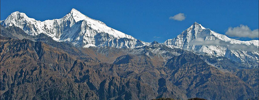
Churen Himal trek lies on western part of Nepal. Churen Himal trekking is completely apart from the beaten paths, this trekking is for the person who love the beauty of nature and the wild valleys of course spectacular view of Dhaulagiri, Annapurna, Gurja himal and churen Himal etc. Churen Himal trek offer an opportunity to discover areas which remain practically an Individual lifestyle. In Churen Himal ( 7371 m) you will have a chance to trek into the mass of the Dhorpatan hills at about 3000-4300m. Churen Himal area is full of rivers and fast glacial streams, lots of forest and animals. Our route crosses magar villages, especially Gurja gaun is very good majority of Mager people. Drive from Kathmandu to Beni via Pokhara we will lead you to the foot of Churen himal. Walk across Myagdi khola in Darbang and we flow the trail Dolpo on till Gurjaghat than you turn to the north Rupala via Gurja gaon, khibang, pakhapani to Beni and from Beni we will drive back to Pokhara.
Tribhuvan International airport (Google Map)
3 Hours Before Flight Time
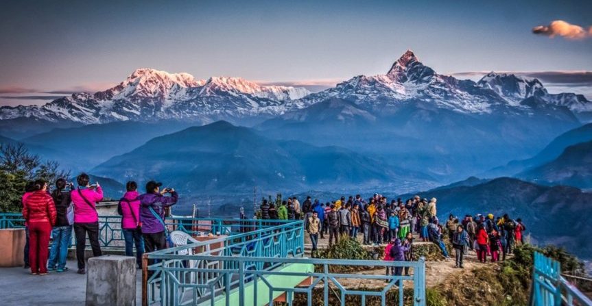
Sightseeing in Pokhara Lake Side Area.
Walk in the shade beautiful forest of conifers then very beautiful path dominating a deep canyon where Myagdi Khola with Dharapani, panorama on Dhaulagiri runs. The fields are cultivated in terraces and planted rice, millet, black corn, mustard, form the mosques ones of fantastic collars.
Go up in forest where molest change and rhododendrons goats. On the trunk of the trees more than centenaries are clutched air ferns and on the branches hang hairy lichens. With the collar Jalja-la (4330m.), Panorama on the solid mass of Dhaulagiri and Annapurnas. Camping with the place says Gurjaghat in the valley of Uttar Ganga close to Dhorpatan. (2800m.)
Beautiful stage of the wild forest (Royal reserve of hunting) refuge of the Himalayan bears, castors, theresa. In autumn the colours are a treat for the eyes. A small path carries out us towards pastures of altitude to Rupachaur Kharka ( 3400m.) Rise of a top of easy access offering an imposing panorama on the solid mass of Dhaulagiri and Churen Himal.
Passage of collar (3700m.) at descent in a valley deep and boxed (bamboo’s, cedars, cascades and also sometimes enormous honeycombs wild to observe under the rock overhangs) to join the large village Magar Gurjagaon (2700m.) located at the foot of Gurja Himal 6hr.
Short stage to the pastures of Darshinge (Camp). Last water point before the watershed that one will go up tomorrow to the collar of Bundzung.
Departure at daybreak, to cross the collar of Bundzunge Bara ( 4450M.). Long watershed offering a panorama on the western slopes of Gurja Himal and Gustung himal. Valley of Thar Cola, Camping wiht Bundzung Kharka.
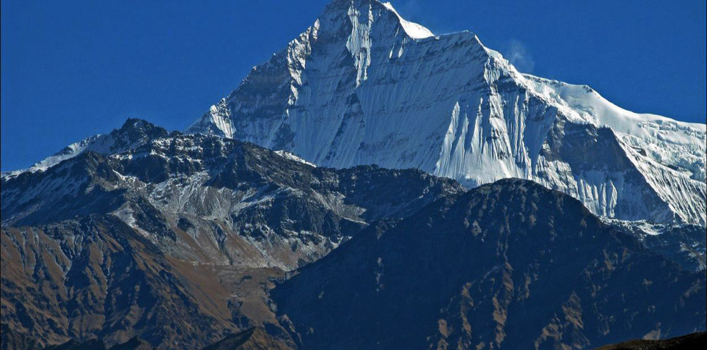
Bundzunge Kharka. Gone up in the valley of Khaphe Khola. The Churen Himal in all its splendor faces draws up his proud pyramid with more than 7000 meters. It is not rare in these places to be able to observe hordes of blue goats of the Himalayans or, for the lucky…… one leopard of snows.
Today exploration of this superb area. Go on moraines to the foot of the large glaciers, observation of nature, fauna, and minerals. Superb, landsca pe and recluses the tops summit Himalayans. Imposing panorama on the immense glacier divalent slopes of Putha Hiunchuli, Dogari Peak and Gustung. One day in the heart of fantastic Himalayan. At the end of day, return to the camping of Bundzunge Kharka.
Passage of Bundzunge Bara and long descent between sky, ground, mountains and valley to the village of Gurjagaon. Panorama on Gurja Himal and its immense western face.
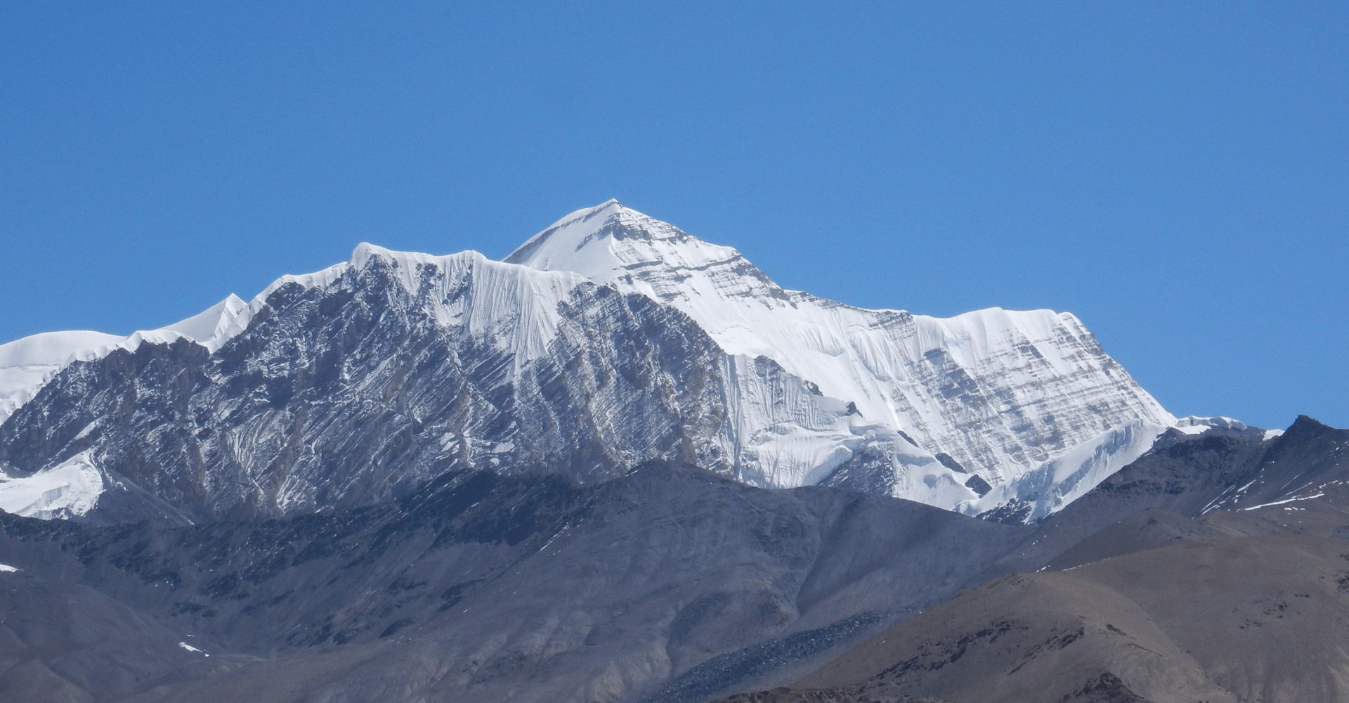
Crossed of Gurja Khola and gone up by one to feel in forest (gaint cedars) with the collar of Deorali (3280m.) Panorama on Putha Hiunchuli, Annapurna I (8091m.), South Annapurna (7219m.), Dhaulagiri I beautiful way in balcony, to join the village of Lulang.
To flance of mountain and through the terrace cultivation, we go from villages in village. Zuppani, Dhara, Muri, Kwibang are of picturesque Magars villages located on the southern slope of Dhaulagiri I (8167m.) 6hr. of walk.
Forests of rhododendrons and villages of Magars until Malkwang. panoramas on the chains of southern Dhaulagiri pouring Camping.6hr. of walk.
Gone up through the terrace cultivation, then crossed of a magnificent and magic forest to the collar Deorali (2800m.) The way leads us to the village of Pakhapani.
Gone up through a beautiful forest of rhododendrons to a collar with 2800m. Descent towards the valley of Rahughat Khola. Return towards the valley of Kali Gandaki. Point of view on Annapurna.