Everest Expedition Nepal
Everest Expedition Nepal
Trek in Nepal
Trek in Nepal
Trek in Nepal

The Mount Everest is the highest peak of the World 29028ft. (8848m.) through which the climbing toppers feel them selves as the most proud and adventurous personnel of the World. Sir Edmond Hillary and Late Tenzing Norge Sherpa first climbed this peak in May 29, 1953, after their long time’s effort.
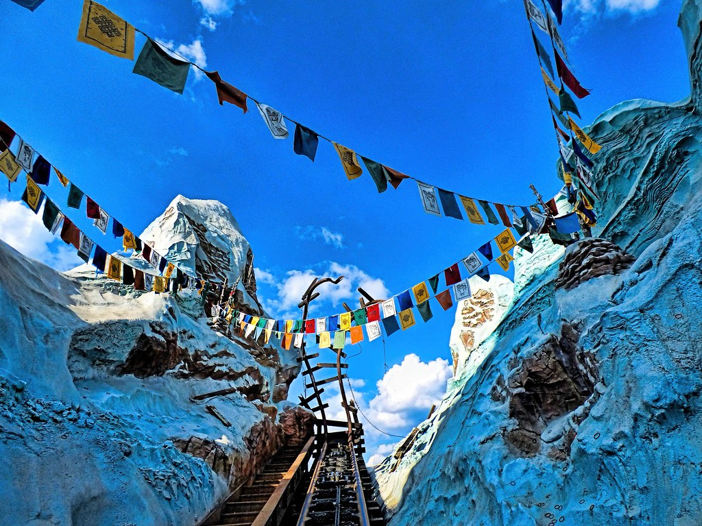
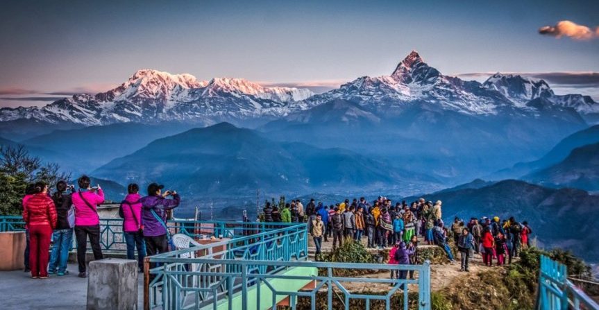
Everest Base camp is situated on the north of Khumbu glacier at high of 18000ft. All the international Mt. Everest climbers assemble here during the starting and at the ending time of there climbing. Normally the climbing duration of this expedition lasts for 90 days. All the climbers who mass there at the base camp seem really busy with excitement for the preparation of their expedition to reach on the summit.
Some climbers climb this mountain on their own risk without any climbing Sherpa guide; and some climbers go with their own climbing Sherpa guide. Most of the teams carry own their on Internet, Satellite phone, Medical Doctor and rest of the modern requirement.
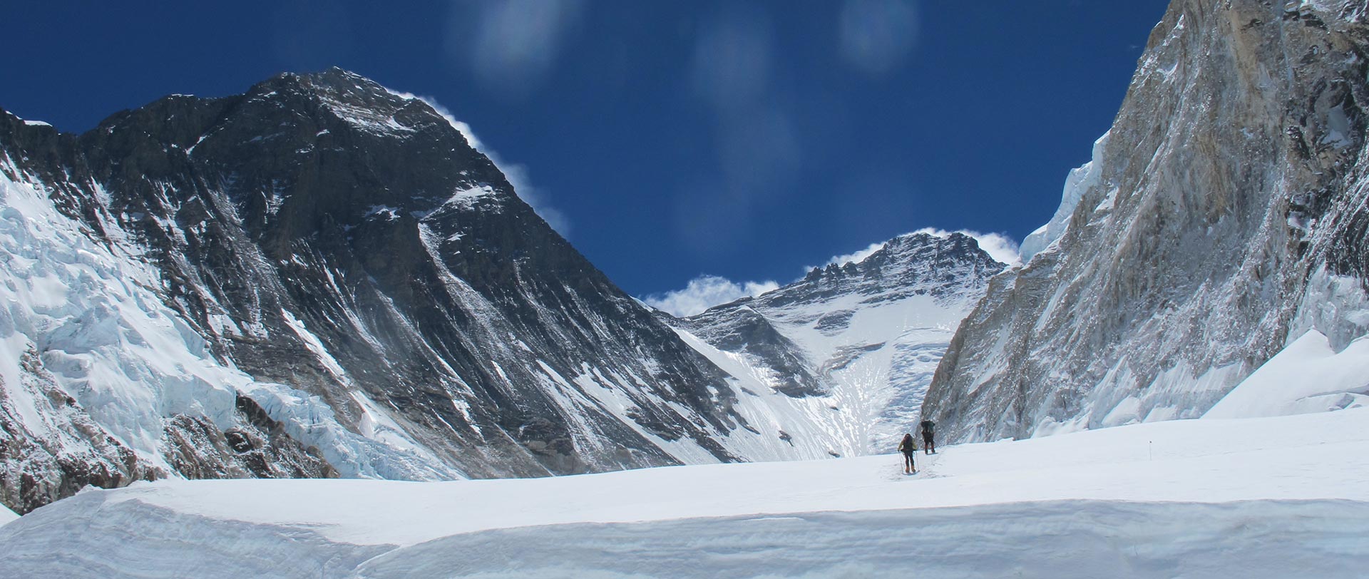
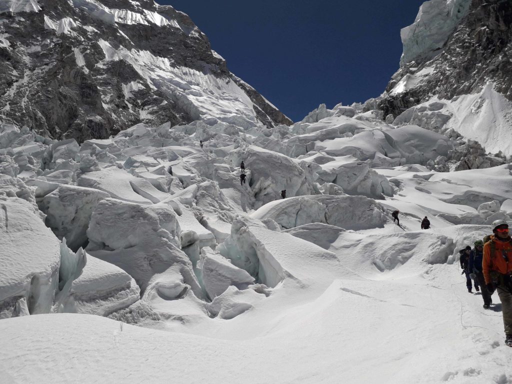
After the Base camp, we have to cross crevasses, Seracs and ice block. Similarly we should face to the way up having Chunks of ice as large as our houses where we should used fixed ropes and aluminum ladders to climb ahead camp 1st 6400m.
Outline Itinerary
Day 1: Arrive Kathmandu
Day 2 & 3: At leisure in Kathmandu
Day 4: Fly Kathmandu to Lukla
Day 5: Trek to Namche Bazaar
Day 6: At leisure in Namche Bazaar
Day 7: Trek to Thyangboche
Day 8: Trek to Dingboche
Day 9-13: Acclimatization
Day 14: Trek to Lobuje
Day 15: Trek to Everest base camp
Day 16-18: Rest and preparation
Day 19-64: Ascent of Mt Everest
Day 65: Withdraw to Base Camp
Day 66-68: Return trek to Namche Bazaar via Dingboche and Thyangboche
Day 69: Trek to Lukla
Day 70: Fly Lukla to Kathmandu
Day 71: Fly Back Home
Tribhuvan International airport (Google Map)
3 Hours Before Flight Time
Upon your arrival in the Kathmandu airport (KTM) you will be greeted by a representative from Beauty Nepal adventure. After completing your custom formalities (Visa, etc) pick up your luggage and look for our representative with a Beauty Nepal adventure display board at the arrival gate. You will be then transferred to Hotel. After check in, you will meet your trekking guide as well as other participants and do final preparation for the trip. Later in the evening we will organize a “Welcome Dinner” at an excellent traditional Nepalese Restaurant where you will enjoy a Nepalese cultural program along with a fine meal.
Sightseeing and Preparation for Everest Expedition. While the leader attends a formal briefing in the Ministry of Tourism, you will explore the fascinating city of Kathmandu. Take rest, familiarize, and make a sightseeing tour to Kathmandu’s World Heritage Sites. We make a guided tour to some of UNESCO World Heritage Sites in the Kathmandu valley: Kathmandu Durbar Square, Pashupatinath, Swayambhu, and Boudhnath. The day will also be for finalizing official procedure and other necessary arrangements. You will be also briefed on the nature of expedition, equipments and team composition. You can also make your last minute buying of personal items as you will be flying to the Himalayas tomorrow. In the late afternoon, the leader will check everyone’s equipment, as Kathmandu is the last opportunity to buy anything missing. You will also get introduced with fellow expedition members and guides.
An early morning scenic flight to Lukla. The mountain flight over to Lukla is one of the most beautiful air routes in the world culminating in a dramatic landing on a hillside surrounded by high mountains peaks. In Lukla, we will meet our camp staff and porters.After meeting our other crew members and with some packing and arrangements, we start our trek through the prosperous village of Lukla until we reach Phakding. Phakding lies on the main trade route through the area and there are a number of clean well-built lodges where we can spend the night.
Continue up the banks of the Dudh Kosi, crossing it twice by small suspension bridges before reaching the village of Monjo where we will enter the Khumbu National Park. Cross the confluence of the Dudh Kosi and the Bhote Kosi on a high suspension bridge and climb steeply for about two hours to reach Namche Bazaar. This is a prosperous trading town and the capital of the Khumbu region with genuine Tibetan artifacts.
We spend a day in Namche Bazar resting and allowing our bodies to become acclimatized to the altitude of 3,450m (11,300ft).Although a leisure day, it’s important not to remain idle. Health experts always recommend us to stay active and moving during the rest day too instead of being idle. We either spend the day taking a day hike to Thame or visiting Khunde or relaxing and exploring Namche Bazaar itself. Namche Bazzar is the main centre of the Everest (Khumbu) region and has government offices, ATMs, Internet cafes, shops, restaurants, a bakery and a colorful market each Friday evening and Saturday. If we trek a few hundred vertical feet during the day, it will help us to properly acclimatize. Our guides will take us to the Tourist Visitor Center near the headquarter of the Sagarmatha National Park where we can observe an assortment of things related to the first Everest ascenders, Sherpa culture and learn about the various plant and animal life of the Everest region.
The well worn Everest trail contours around the side of the valley high above the Dudh Kosi. Follow the path, savoring the first really good views of the great peaks of the Khumbu: Everest, Lhotse, Nuptse and Ama Dablam. Passing by several villages and numerous tea shops, cross the Dudh Kosi River and make a steep climb to Thyangboche, home of an impressive and newly rebuilt monastery.
We pass through several Chortens and Mani walls and small villages. We enjoy lunch with fantastic close-up views of Ama-Dablam. Shaded by rhododendron trees, the path leads gradually down to the river once again to another airy suspension bridge. An hour’s walking from here brings us to Pangboche, an excellent viewpoint for Ama Dablam. Contouring up the valley side, re-cross the river and turn up the Imja valley to reach the picturesque farming village of Dingboche.
This is an important phase of the expedition. Dingboche is a good location for acclimatization. The team leader will organize daily outings to the adjacent hills with the aim of providing gradual acclimatization. Walk some of the nearby hills in order to slowly increase exposure to altitude. Follow the regime that you have previously found most suitable, in order to give you maximum acclimatization before arrive in base camp.
While in Dingboche, we can attend a seminar on high altitude acclimatization at a hospital run by the Himalayan Rescue Association nearby Pheriche. The walk over to Pheriche and back will also serve as good acclimatization training.
Retrace back to Pheriche before continuing up the trail towards base camp. Reach Dugla situated below the snout of the Khumbu Glacier, a convenient place for lunch. After lunch, the trail starts steeply to climb up beside the glacier moraine. After a couple of hours the track eventually leads to a small cluster of tea houses pleasantly situated at Lobuje.
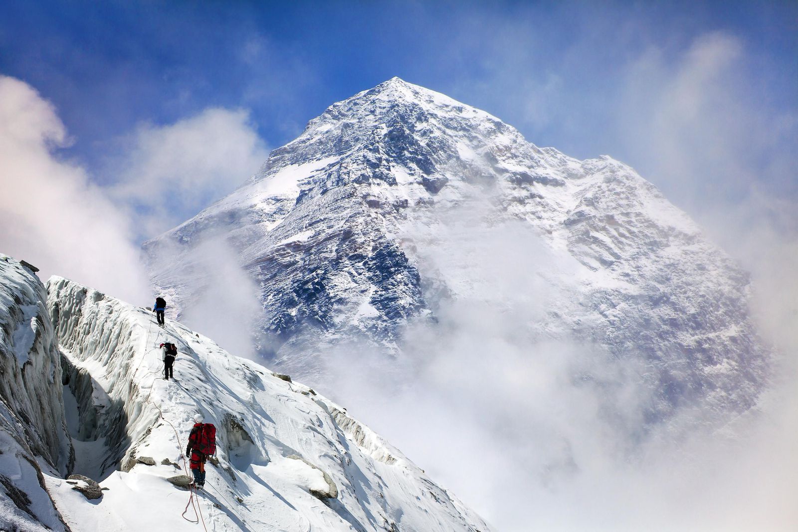
Contouring along the valley-side and looking down on the Khumbu Glacier, follow a reasonable trail to Gorak Shep. This was the site of the base camp in 1953 and now consists of a few small tea houses. Leaving Gorak Shep, the trail leads on to the moraine of the Khumbu Glacier and becomes quite vague, weaving between mounds of rubble and eventually reaching base camp near the foot of the Khumbu Icefall. This will be our home for the next six weeks.
All team members return to base camp and assist with packing expedition stores and cleaning the base camp area.
We will return to the welcome haven of the Hotel. Once back in Kathmandu, Himalayan Glacier will host an evening barbecue to celebrate the expedition and as a farewell party to thank the Sherpas for their support and friendship.
The Base Camp of Mount Everest at 5,200 m (17,500 feet) on a glacial field lies higher than most of the tallest peaks in the Alps and the Andes. It’s necessary to spend enough time at the Base Camp to allow your body for high altitude acclimatization. You must feel fully comfortable before embarking further from the Base Camp. You can ascend a smaller peak, Kala Patthar which gives the views of Mount Pumori and the stark black pyramid of Everest itself. There will be a puja at the Base Camp with the Buddhist chants, prayers, and incense and prayer flags for the successful passage.
After the Base camp, we cross crevasses, sercs and ice black. Similarly we face large chunks of ice on the way up. The Sherpas fix the Khumbu Ice Fall with ropes and ladders. Use fixed ropes and aluminum ladders to climb ahead to camp 1 at 6400m. Camp 1 is situated at the top of the ice fall on a flat area of snow. Camp 1 also functions as an intermediate camp until Camp 2 is established at 21,000ft in the Western Cwm.
Camp 2 is located at the foot of the icy mount Lhotse wall. Weather is fine here mostly except for the clouds that roll in from the low range. There can also be violent wind. Camp II will be the base during the placements of Camp 3 and Camp 4. Hence, Camp 2 will consist of large tents for cooking and dining and several small tents for sleeping.
Camp 3 is located at the height of 22300ft, adjoining to mount Lhotse wall. Climb the Lhotse wall using fixed rope and leading to camp 4. Ascend the steep down-slopping rotten limestone. Cross short snowfield route that moves ahead to the east before finishing the flats of the south col. Keep oxygen supply handy.
Oxygen will be used above Camp 3. Beyond camp 3, there may be some discomforts due to thinning air necessitating use of oxygen. Climbers need to go through the steep allow bands. Cross short snowfield, the route takes up the Geneva Spur to the east before finishing the flats of the south col. Camp 4, located height of 8,400m, is the last camp of the Expedition.
The final and dangerous part of the climbing. Chances of encountering violent wind. The summit is about 500m from Camp 4. The normal best way to reach to summit is via the narrow South – East Ridge.
The Mount Everest is the highest peak of the World 29028ft. (8848m.) through which the climbing toppers feel them selves as the most proud and adventurous personnel of the World. Sir Edmond Hillary and Late Tenzing Norge Sherpa first climbed this peak in May 29, 1953, after their long time’s effort.
Everest Base camp is situated on the north of Khumbu glacier at high of 18000ft. All the international Mt. Everest climbers assemble here during the starting and at the ending time of there climbing. Normally the climbing duration of this expedition lasts for 90 days. All the climbers who mass there at the base camp seem really busy with excitement for the preparation of their expedition to reach on the summit.
Some climbers climb this mountain on their own risk without any climbing Sherpa guide; and some climbers go with their own climbing Sherpa guide. Most of the teams carry own their on Internet, Satellite phone, Medical Doctor and rest of the modern requirement.
After the Base camp, we have to cross crevasses, Seracs and ice block. Similarly we should face to the way up having Chunks of ice as large as our houses where we should used fixed ropes and aluminum ladders to climb ahead camp 1st 6400m.
This camp 1 is situated at the flat area of endless snow deep crevasses and mountain walls. Because of the Sun’s reflection from this place we get warm and heating ambience at this place. In the night we listen the deep murmuring cracking sounds of crevasses beneath our tent. These are the areas where we have to walk to reach camp 2.
This camp 2 is situated at the height of the 21000ft, which is located at the foot of the icy mount Lhotse wall though where we have to go ahead. Weather is here is good but bad clouds roll in from the low range of the Himalayan valleys to the bottom of our camp two. But wind here some times seems very violent enough to destroy our tents. After climbing these palaces we reach camp 3.
Camp 3 is located at the height of 22300ft, adjoining to mount Lhotse wall. After climbing the 4000ft. Lhotse wall by using fixed rope and with prior acclimatization it leads us to camp 4. Also on the way we have to ascend the steep allow bands (lose, down -slopping and rotten limestone). From their crossing short snowfield the route moves ahead up the Geneva Spur to the east before finishing the flats of the south col. (Another wells name meaning Saddle of pass). Oxygen should probably be use above base camp 3 incase of needed to the climbers.
Now we are on camp 4 which located at the height of 26000ft; it is the last camp of the Expedition. From here summit is about 500m, distance far. This is the final and dangerous part of the climbing. This place is besieged by ferocious and violent winds. The normal best way to reach the summit is via the narrow South – East Ridge and it precedes the South Summits 28710ft.
From here the way is easy to reach at the summit of the Everest 29028ft; and late Sir Edmond Hillary and l Tenzing Norge Sherpa used this route in 1953.